
Gunung Walat, Sukabumi – The Ecological Social Mapping of FMSC of Forest Management Department of IPB Faculty of Forestry took place on July 21-25, 2012 in the Gunung Walat University Forest.
Ecological Social Mapping (ESM) was a part of identification activities regarding the socio-economic interaction scheme of the community around Gunung Walat University Forest (GWUF) with existing forest resources inside it. ESM is an exploration activity carried out by multi-disciplines sciences in the Department of Forest Management, Faculty of Forestry, Bogor Agricultural University (IPB) which includes forest planning, forest hydrology, utilization of forest resources, and socio-economic communities around the forest. ESM activity is designed by each study group (KS) in the FMSC profession association. This activity will produce a social and biophysical interaction scheme in GWUF.
The theme of this ESM activity is the exploration of resources and communities interaction in Gunung Walat University Forest (GWUF).
The aim of ecological social mapping activities is 1. Implementing the Study Group science in FMSC; 2. Mapping the interaction of communities around the forest with forestry resources in GWUF; 3. Increasing public knowledge in sustainable forestry resources utilization.
ESM members in 2012 totalled 45 people consisting of students of the Forest Management Department, Faculty of Forestry, IPB.
ESM activities began with literature studies with basic data collection such as location and area of GWUF, general forest conditions, and the socio-economic conditions of the surrounding villages including population data, livelihoods, administrative systems, and levels of productivity. From the results of literature studies, each study group (KS) will prepare a field verification plan. The socio-economic KS team will conduct interviews related to population data and various uses of forest resources in the surrounding community.
ThePlanning team KS then will make coordination maps of Gunung Walat University Forest (GWUF) to place the sampling plot so that it represents the overall potential of forest resources and the coordinates for field verification. This is inseparable from the KS Planning task to assist the KS Utilization and Hydrology team in determining the plot of fuelwood potential measurement and the location of the river.
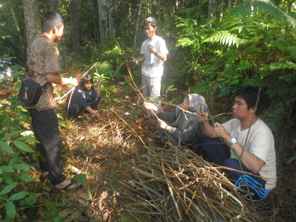
Team Forest Utilization KS will identify the potential of fuelwood in GWUF. Potential measurement is done by making Primary Measuring Plots (PUP) and Secondary Measuring Plots (PUS) made on each type of wood in GWUF, so that the measurement results can represent the total potential in GWUF.
Then, the Hydrological KS team will carry out biophysical identification in the form of hydrological mapping, calculation of water discharge, erosion and sedimentation, analysis of water function in GWUF, that are either utilized or not used by the community, around GWUF.
The Socio-economy KS team will also collect information about community forests and agroforestry to communities around GWUF to encourage and increase public knowledge about community forests and agroforestry in the context of land optimization.
From the data obtained by each KS, it will be discussed together to create a scheme of community interaction with forest ecology in GWUF with written documentation in the form of maps or pictures of the interaction between the community and forest resources in GWUF.
For their own impression about GWUF is good, the staff have been able to explore forest resources (especially fuelwood and water) in GWUF. However, for potential calculations, benefit analysis and location documentation have not been calculated, so that the data, analysis, and documentation of these ESM activities can also be useful for GWUF managers
Author: Khabibi Nurrofi` P (Chairperson of 2012 ESM)
Photo gallery click here
Download news click here